
Footpaths to wild places & green spaces
Maine’s land trusts provide miles of hiking trails to freely explore.
By Lynn Ascrizzi
Canal Path, a 3-mile Georges River Land Trust trail in Searsmont, is laid out along the berm of a late 1700s canal system. It’s an easy hike with great river views—a good choice for all ages. Photo: Jay Astle
Maine is renowned for its hiking opportunities in the northern and western mountains and in the famed Acadia region. But did you know that a network of trails, managed by local and statewide land trusts, provides precious public access to hundreds of miles of scenic woods, wetlands, open fields and water views—footpaths that include urban trails? And, they’re free to explore!
That’s right. These local organizations—and there are close to 100 such trusts in Maine— have worked hard to keep the state’s beautiful wild places and green spaces open for all of us. Through their collaborative efforts, you can get out and jump on a footpath near you for a day-hiking adventure.
One fine example, among many, of these grassroots groups, is Georges River Land Trust, based in coastal Rockland. “We conserve land,” said the trust’s stewardship program man- ager, Jay Astle. The nonprofit group maintains 60 miles of midcoast region trails called Georges Highland Path, that cover terrain divided into five, distinct sections.
“Our trails get you close to nature. You feel like nobody has come before you,” said Astle.
GRLT’s low-impact, well-managed and well-marked trails pass through natural wildscapes that are no more than a 30-minute drive from the coast. Trails are rated from easy to arduous. Hikers have 20-plus trails to choose from, each with different lengths and terrain. Many trails loop and link with others, creating a network of choices that can extend your hike.
The land trust also provides 15 trailheads, or trail entry points, each with an information kiosk and take-along trail maps. Parking areas are indicated on maps, also available at their website: www.georgesriver.org.
To get printed maps, ask questions and learn about free events, such as guided trail hikes, you can visit the Georges River Land Trust office at 8 North Main Street, Rockland. Hours: 10 a.m. – 3 p.m., Monday through Friday.
The following are three popular but very different GRLT footpaths, ranging from easy to difficult:
Canal Path
If you’d like to take it easy and see fantastic scenery to boot, then Canal Path is a perfect choice. The 3-mile trail is named after a late-1700s canal system, some of which is still visible along the Georges River. Interpretive displays provide information about the old canal.

Birders search the trees on a Georges River Land Trust trail. Photo: Jay Astle
“It is a relatively flat trail, a good option for the whole family,” said Astle. “You have great riverside views. It’s one of my favorite trails.”
Along the way, bird lovers have the opportunity to spot ospreys, great blue herons, warblers, kingfishers, and more. And, there’s plenty of Maine’s diverse plant life to enjoy— reeds, shrubs, alders, old apple trees, wild blueberries, native wildflowers and white pine, beech, fir and spruce. “It’s a quiet part of the Georges River Watershed,” he said.
An added bonus: The Canal Path connects to The Ridge to River Trail, a 4-mile, GRLT footpath that winds its way to the top of Appleton Ridge in Appleton. “It’s not as challenging as the mountain trails, but it gives you expansive views of the Georges River Valley. Kids can do it, depending upon their age,” he said.
To the trailhead: From Belfast, take Route 3 to Route 131, to Searsmont. From Rockland, take Route 1, and turn north on Route 131, into Searsmont. The trailhead is right off Route 131, on Ghent Road.
Hogback Mountain
Hogback is a modest-sized, 1,115-foot-high mountain in Montville. The trail takes you through a young hardwood forest, past a giant glacial erratic dubbed “piano rock,” and up a moderate ascent past small waterfalls, to its open mountaintop. Hikers are rewarded with a sweeping southerly view of Montville, and on good days, they can see Penobscot Bay and Ragged Mountain.

Jim Merkel, amateur botanist leads an edible plant walk in early summer on the Bog Brook Trail, maintained by Sheepscot Wellspring Land Alliance. Hogback Mountain is a two-mile walk from the Bog Brook trailhead in Montville. Photo: Buck O’Herin
“It’s for people in relatively good shape. There are big ups and downs. You can always go in a few miles or so and walk out,” Astle said.
If you keep heading west from Hogback’s summit, the GRLT trail links to one managed by Sheepscot Wellspring Land Alliance (SWLA). This trail will also put you in touch with the Montville-based trust’s 19-mile footpath network.
In fact, the easiest access to Hogback is to start from SW- LA’s Bog Brook trailhead in Montville. This moderately challenging, meandering path, which takes you past old growth hemlocks and a secluded headwater marsh, is only two miles from the base of Hogback, where the ascent begins.
“These wild lands are really important for local biodiversity and ecosystems,” said longtime SWLA board member Buck O’Herin. “A lot of birds use the area. Some warblers and other birds need interior forest for nesting and habitat, away from roads and development.”
To the trailhead: From Belfast, take Route 3, west to Route 220, north. Go about 3.2 miles to Halldale Road. Bear left onto Halldale, and in 0.6 miles you’ll see the Bog Brook trailhead kiosk, on your right, just before a large beaver pond.
A longer way to Hogback is via the 5,000-acre Frye Mountain Wildlife Management Area in Montville, also accessed from Route 220. You might want to tackle Frye Mountain trails, too. There’s plenty in this region to return to and re-explore.
Ragged Mountain
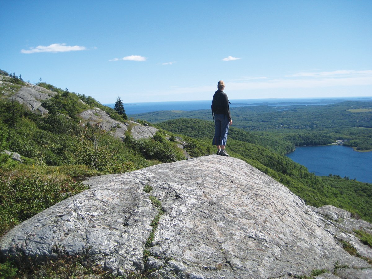
One of Georges River Land Trust’s most strenuous trails is Ragged Mountain, which rises up 1,200 feet in Camden and Rockport. “It’s almost a straight, uphill climb—about a 3-mile hike, to get to the top. But, the payoff is extraordinary,” Astle said.
A hiker pauses atop a granite outcropping on Ragged Mountain, overlooking Penobscot Bay. Photo: Courtesy of Georges River Land Trust
On clear days, hikers get embracing views of Penobscot Bay and can see all the way to Acadia National Park and Cadillac Mountain. Westerly vistas include Georges River watershed, Mount Washington, the White Mountains and Maine’s western mountains.
The first half of the trail passes through an open understory of oaks and other hardwoods. As you climb, more views are gained. The open summit consists of exposed granite ledge. Plant life includes windswept wild blueberries and alpine flora. A tip: “If you start out too early, a fog bank might blanket views. Pick a clear day,” he said.
To the trailhead: The most popular access is located two miles north of the intersection of Routes 17 and 90, the shortest way to the top. In summer, parking can get difficult. In that case, and for an easier way to the top, use the Hope Street trail- head, located 2.5 miles north of the Routes 17 and 90 intersection. Or, go to the Barnstown Road Trailhead, set 1,000 feet south of the intersection of Barnstown and Gillette roads, in Camden.
Portland Trails: Urban escapes into natural greenery and scenery
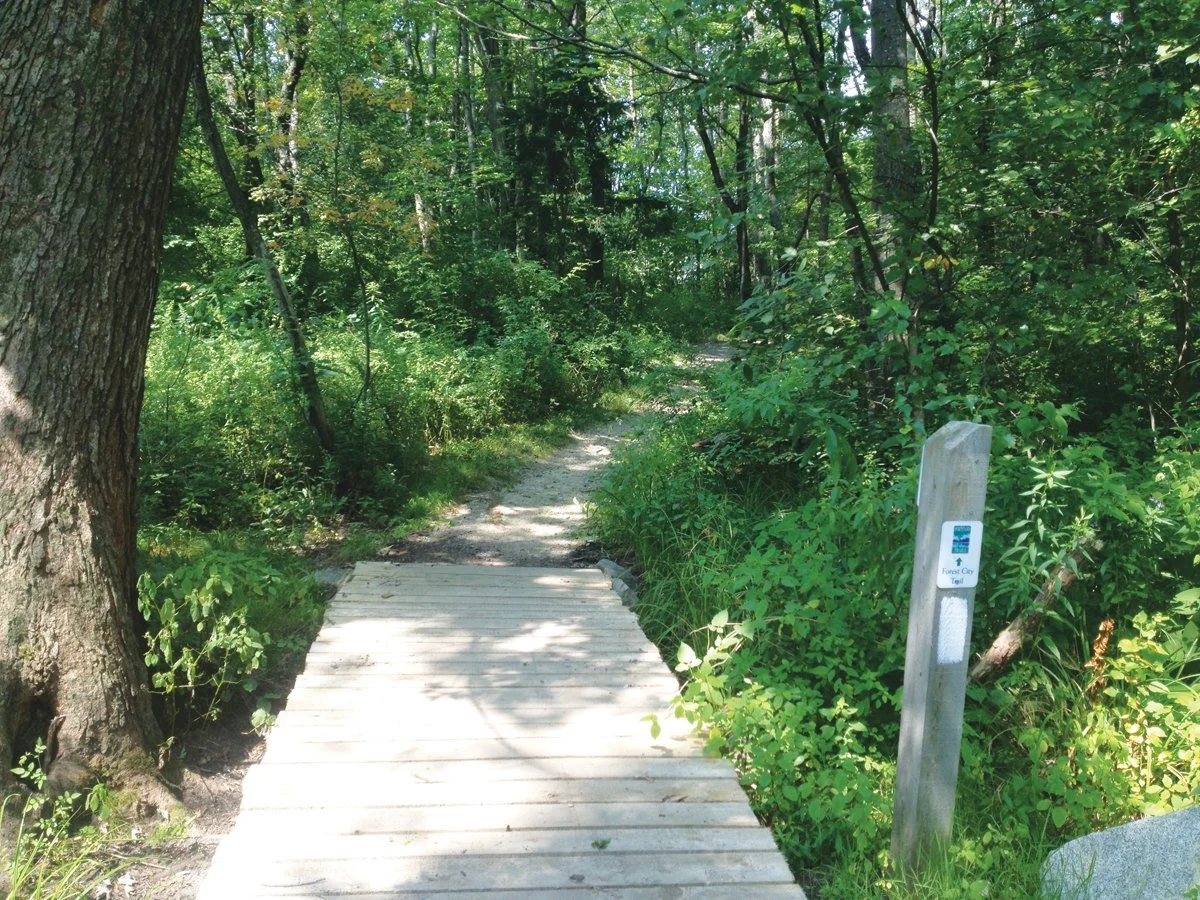
A boardwalk segment of the Forest City Trail, a 10-mile-long pathway that stitches together several natural green spaces of the Portland area. Photo: Courtesy of Portland Trails
Tucked away amid the coastal city of Portland, Maine, are an amazing number of accessible green spaces and walking places maintained by Portland Trails, a non-profit land trust whose mission is to restore urban nature.
So, while you’re delighting in the historic Old Port district, with its gift shops, cobblestone streets and fabulous food, or soaking up culture in the arts district on Congress Street, think about extending your recreation- al downtime by exploring a section of the land trust’s 70 miles of well-maintained, naturally beautiful hiking paths.
“One of the most amazing things about Portland is the combination of urban amenities and stunning natural beauty,” said Jaime Parker, trails manager for Portland Trails. “Our trail system links downtown to neighborhoods, parks, Casco Bay and the rivers flowing into it, and in doing so, creates a truly walkable city.”
Some natural delights seen along the trails include exhilarating views of Casco Bay, seasonal wild flowers, diverse bird life, river views and even a waterfall.
The following suggestions are but a handful of the city’s generous array of walking and hiking paths whose refreshing greenery and scenery provide a welcome complement to the buzz and excitement of city life.
Presumpscot River Preserve

River view along the 2.5-mile Presumpscot River Preserve trail, located only 3 miles from downtown Portland. Photo: Courtesy of Portland Trails
This 2.5-mile trail is a surprisingly hidden getaway, located only 3 miles from downtown Portland. The dirt trail follows a deep ravine along the Presumpscot River, which flows from Sebago Lake to Casco Bay.
“It’s one of my favorite places to go for a run, said Kara Wooldrik, Portland Trails executive director. “It feels as if you’re 100 miles away.”
The forested trail is a popular spot for mountain biking, fishing, hiking, birding and dog walking. Along its wooded, dirt pathways (steep in places) are a number of small wooden boardwalks and bridges that pass over wet areas.
The trail also provides great river views, an opportunity to see osprey, eagles and other birds fishing, and to hear the rumble of the broad, one-story-high Presumpscot Falls. A canoe and kayak portage area is available near the falls.
“It’s absolutely gorgeous. I always send people to Presumpscot Falls,” said trail manager Jaime Parker. “It’s stunning after a heavy rain.”
“Every time I go out there, I have magical moments,” Wooldrik added. “I’d say the same for the Eastern Prom Trail. I tell myself: ‘I’m so lucky to live here.’ ”
Eastern Prom Trail
This 2.1-mile urban trail is located at the northeastern edge of the city’s peninsula and imparts a romantic sense of quintessential Portland, with its panoramic views of historic homes in the Munjoy Hill area and fabulous sights across Casco Bay.

The Eastern Prom Trail is a favorite with walkers, runners and bikers alike. Photo: Heather Chandler
Views include Peaks Island, Fort Gorges, Little Diamond Island, two lighthouses (Spring Point and Bug Light) and more. “Boat traffic goes in and out of the waterfront. Cruise ships come in nearby, too,” Wooldrik said.
The Eastern Prom trail is wheelchair accessible, a paved path that stretches from Commercial Street to Tukey’s Bridge near I-95. Dogs on leashes are allowed. For a longer hike, the northern end of the trail connects with the 3.5-mile-long Back Cove Trail.
At the southerly end of the Eastern Prom is East End Beach, an area used to launch kayaks and canoes. Bring your own kayak or you can rent a kayak or standup paddleboard, at a rental shop near the beach.
The trail is accessed at the corner of India and Commercial Streets. “People enjoy the India Street restaurants and cafes near Commercial Street. From either end of the trail, you can get amazing, gourmet food,” Wooldrik said.
For extra fun, visit the Maine Narrow Gauge Railroad Co. and Museum, which is directly adjacent to the southern end of the Eastern Prom Trail, off Fore Street. The mile-long train trips are popular with visitors and railroad buffs.
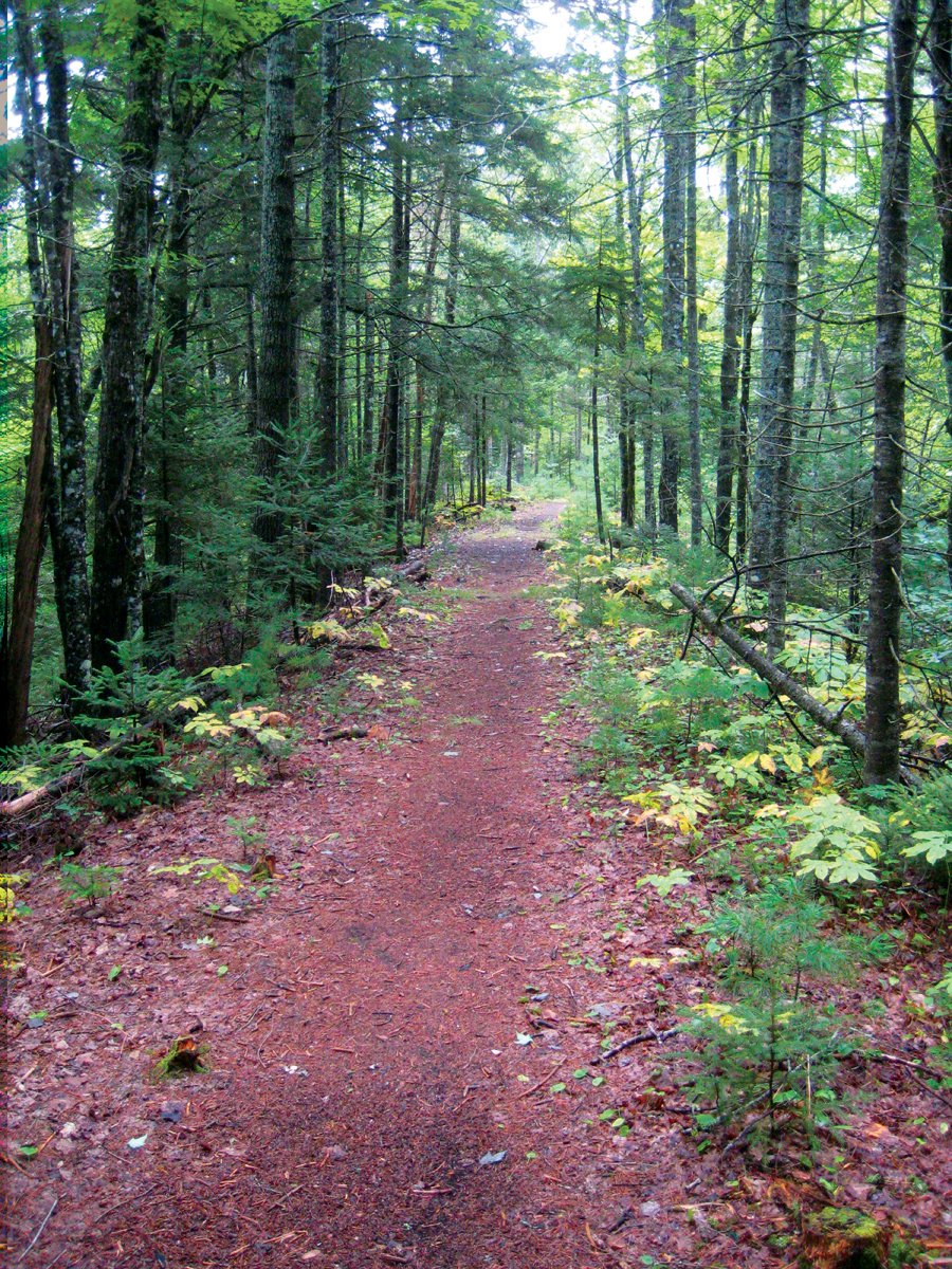
Forest City Trail
This 10 mile-walk, which takes a few hours for those who want to go the distance, ties together multiple trails within the city limits. It crosses Portland, starting at Stroudwater River and ending at the Presumpscot River.
“The trail goes through some of the largest green spaces in Portland, including Fore River Sanctuary,” Parker said. It passes through neighborhoods, behind a school, and traverses 25 acres of natural woods at Evergreen Cemetery. “It’s a great way to stitch the natural areas together,” Wooldrik said.
Stroudwater Trail
The 2.1-mile paved Eastern Prom Trail connects with the Back Cove Trail for more than five miles of off road fun. Photo: Heather Chandler
This 3.25-mile gravel and dirt trail follows the beautiful Stroudwater River that flows from Westbrook, passes through a forested section, moves past Portland’s Stroudwater neighborhood, and empties into the Fore River. “Much of the trail is up high. You look down on the river,” Woodrik said.
The 8-foot-wide path is a favorite with runners, dog walkers, mountain bikers and skiers. Its distance from downtown Portland makes hikers feel far away from the city. Plant lovers will discover seasonal wildflowers, such as yellow trout lilies and lady slippers.
Fore River Sanctuary
This 85-acre preserve is home to Portland’s only natural waterfall, the 25-foot-high Jewel Falls. The sanctuary is only 4 miles from downtown Portland, and is open year-round, from dawn to dusk. Among other things, hikers will enjoy the preserve’s 2-mile Canal Trail, an area that offers a diverse range of habitat and bird life, such as wading and song birds.
“The sanctuary is a great network of looped trails that pass through upland marshland and along several stream beds. It’s the jewel of our network—an oasis within the urban environment,” Parker said.
Find your path
There are almost 100 land trusts and conservancy organizations in Maine. The following list includes a sampling of land trusts located in coastal and Sebago Lake areas.
Blue Hill Heritage Trust
258 Mountain Road, Blue Hill
207-374-5118
info@bluehillheritagetrust.org | www.bluehillheritagetrust.org
The Blue Hill Heritage Trust has protected over 7,000 acres in the region that includes Blue Hill, Brooklin, Brooksville, Castine, Penobscot, Sedgwick, and Surry.
A highlight: the 4.5 mile trail up and over Blue Hill Mountain with views of Blue Hill Bay, Acadia, and Camden Hills. The new Becton Trail offers views of Toddy Pond and Great Pond Mountain to the north.
Boothbay Region Land Trust (BRLT)
60 Samoset Rd. Boothbay Harbor, ME
(207) 633-4818
nullo@bbrlt.org | www.bbrlt.org
BRLT preserves provide more than 30 miles of well-marked, pet-friendly, scenic hiking trails open year-round to the public. Most trails are not difficult.
A highlight: Ovens Mouth Preserve, 146 acres set on two peninsulas that jut between Back River and Cross River. The combined 2.85 miles of eastern and western shoreline trails, which loop through forested areas and end up at the water, boast eight vistas.
Brunswick-Topsham Land Trust (BTLT)
179 Neptune Dr., Brunswick
207-729-7694
info@btlt.org | www.btlt.org
BTLT owns 600 acres and maintains five trail systems.
A highlight: Only 1.5 miles from downtown Brunswick is Crystal Spring Farm. Its 5 miles of trails offer views of working farm fields, sheep, woods, the Tom Settlemire Community Garden, and more.
Cape Elizabeth Land Trust (CELT)
330 Ocean House Road, Cape Elizabeth
207-767-6054
info@capelandtrust.org | www.capelandtrust.org
CELT has permanently protected more than 650 acres of land for public benefit. Its roughly 24 miles of trails are only miles away from the city of Portland, set within diverse habitat—tidal saltwater marshes, old- growth forest, ocean promontories, sandy beaches, conifers and fields.
A highlight: Seven-acre Trundy Point, a rock outcropping, offers expansive views of Casco Bay on a clear day, including five lighthouses and a sheltered beach, perfect for picnics.
Freeport Conservation Trust (FCT)
Freeport Community Center
53 Depot Street, Freeport
(207) 865-3985, ext. 212
info@freeportconservationtrust.org | www.freeportconservationtrust.org
FCT has partnered with community organizations to connect and conserve more than 1,500 acres of open space and 20 miles of public trails, which includes forest, farmland, shoreland, woods and wildlife habitat.
A highlight: Hedgehog Mountain, 196 acres with 5 miles of trails that lead past mature pines and hemlocks, up the “mountain,” the highest point in Freeport.
Kennebunk Land Trust (KLT)
6 Brown Street, Suite 2, Kennebunk
(207) 985-8734
info@kennebunklandtrust.org | www.kennebunklandtrust.org
KLT is one of Maine’s oldest working land trusts and has helped preserve more than 3,400 acres of upland forests, coastal marsh, fields and waterways.
A highlight: Alewives Wood Preserve, with a 45-acre pond set like a jewel in the middle of 625 acres, offers 2.5 miles of easy-to- moderate trails that meander through a red pine plantation. Activities include bird watching, biking, dog walking and blueberry-picking in summer.
Loon Echo Land Trust
8 Depot Street #4, Bridgton
207-647-4352
www.loonecholandtrust.org
Loon Echo protects 5,900 acres of land in the northern Sebago Lake region and manages 25 miles of trails available for walking, hiking, cross- country skiing, snowshoeing and in designated areas, motorized use.
A highlight: Bald Pate Mountain Preserve, 6.7 miles of trails set within 486 acres of forest, meadows, granite-topped vistas, and an ancient pitch pine forest atop the summit.
Saco Bay Trails
P.O. Box 720, Saco
(207) 286-9295
trails@sacobaytrails.org | www.sacobaytrails.org
This land trust manages 16 trails that cluster near Old Orchard Beach, and has made available miles of hiking jaunts though diverse habitat.
A highlight: The Atlantic Way, Plymouth and Vine trails lead walkers to the Rachel Carson National Wildllife Refuge. On the easy-to- moderate, 2.2-mile Atlantic Way segment, you can spot deer, wild turkeys, wild ducks, herons and other waterfowl.
Pemaquid Watershed Association (PWA)
15 Courtyard Street, Damariscotta
207-563-2196
info@pemaquidwatershed.org | www.pemaquidwatershed.org
PWA maintains several nature preserves around the Pemaquid Peninsula and provides access to 9 miles of trails and shorefront.
A highlight: The 120-acre LaVerna Preserve, off Route 32 in Chamberlain comes with diverse wildlife habitat, 3,600 feet of fantastic rocky shorefront along Muscongus Bay and 2.5 miles of trails.
To find a Portland Trail
For trailhead access to the urban trail systems listed here, and for other pathways and preserves in Portland, you can find printed maps at the Portland Trails office, 305 Commercial Street, Portland, Maine, (207-775-2411). Or, get their maps online: www.trails.org.
To find more Maine land trusts
MAINE LAND TRUST NETWORK: www.mltn.org
MLTN, a program of Maine Coast Heritage Trust, seeks to strengthen the land conservation community by acting as an information hub and by facilitating conferences, workshops and other programs and services.
MAINE TRAIL FINDER: www.mainetrailfinder.com
This online database lists four-season trails throughout the state by trail name, city, town or township, county and trail activity, to help you locate the adventure you seek.
